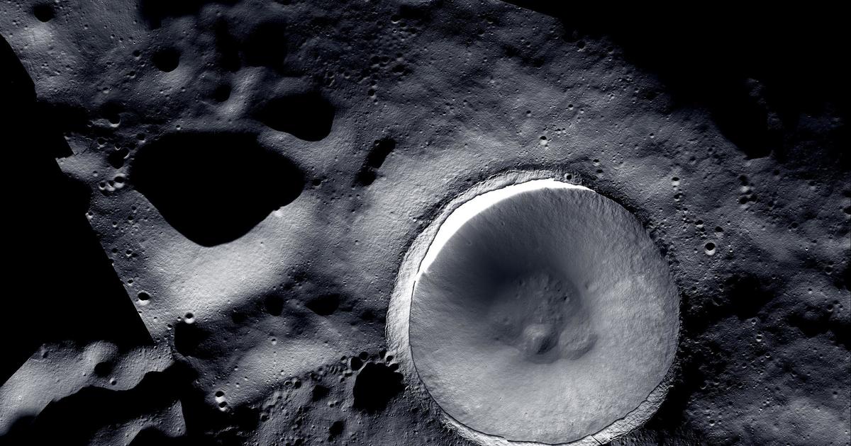

NASA's release of a new mosaic image of the Moon's south pole region is generating significant excitement within the scientific community, showcasing "unprecedented detail" of a region crucial for future lunar exploration. The high-resolution image, compiled from data gathered by the Lunar Reconnaissance Orbiter Camera (LROC) over many years, offers a dramatically improved view of the permanently shadowed craters and rugged terrain that characterize this area. This unprecedented level of detail allows scientists to perform analyses previously impossible. The clarity reveals minute surface features, including subtle variations in crater morphology, the distribution of regolith (lunar dust and rock), and the precise locations of potential resources like water ice. The presence of water ice is of paramount importance, as it could be utilized for life support, rocket propellant, and even in situ resource utilization (ISRU) to produce breathable oxygen. The mosaic is not simply a pretty picture; it's a vital tool for mission planning. Agencies like NASA and the ESA are actively developing plans for crewed and robotic missions to the lunar south pole, aiming to establish a sustainable lunar presence. The high-resolution imagery will be instrumental in selecting safe and scientifically valuable landing sites, optimizing mission trajectories, and identifying potential hazards for astronauts and robotic explorers. The increased detail also provides crucial context for understanding the Moon's geological history. The permanently shadowed craters, constantly shielded from sunlight, offer a unique record of early solar system processes, potentially preserving volatile compounds and materials unchanged for billions of years. Studying these areas through this improved imagery could unlock valuable insights into the formation and evolution of the Moon and the inner solar system. In short, the new mosaic image isn't just a technological achievement; it's a foundational resource that will dramatically enhance our understanding of the Moon's south pole and accelerate the pace of lunar exploration, paving the way for future human activities on the lunar surface. The level of detail opens new avenues for scientific discovery and informed decision-making for the next generation of lunar missions.

Thanks to two lunar orbiting cameras working together on the moon's Shackleton Crater, has been able to release a mosaic showing "unprecedented detail" of the region.
Shackleton Crater is in the moon's South Pole region. The area is of interest to scientists because it may have accessible ice deposits in its craters, . That ice could be a source of air, water and rocket fuel. India's Chandrayaan-3 lander safely landed in the region in August 2023, and NASA's Artemis program is planning to send astronauts to this area in the next few years.
The mosaic images were captured thanks to the technology on two cameras working in sync. The Lunar Reconnaissance Orbiter Camera can capture detailed images of the moon's surface, NASA said in a news release, but has only "limited ability" to photograph the shadowed areas of the lunar body. These permanently shadowed regions never see sunlight, so the LROC can never take good photos of them.
That's where the ShadowCam comes in. A NASA instrument on board a Korean spacecraft, the ShadowCam is "200-times more light-sensitive than LROC and can operate successfully in these extremely low-light conditions," according to the agency. This reveals features and terrain details that wouldn't otherwise be visible. However, this light sensitivity means it can't capture directly illuminated parts of the moon - those areas are where the LROC works the best.
Combined, the two cameras were able to capture images that were combined "to create a comprehensive visual map of the terrain and geologic features of both the brightest and darkest parts of the Moon."
The images show the moon's permanently shadowed areas in "greater detail than previously possible," allowing scientists to study the area like never before. With this complete map, researchers will be able to conduct more thorough surface exploration endeavors, NASA said, like the Artemis missions intended to search for ice and establish a long-term U.S. presence on the moon.


